Property Record
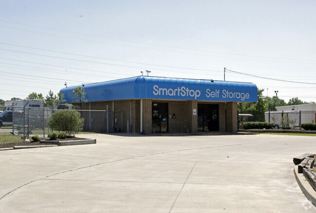
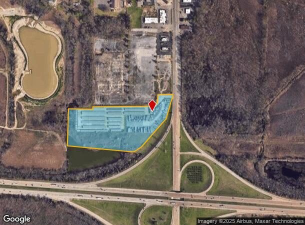
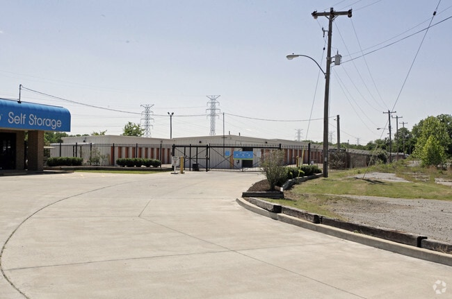
2555 N Hollywood St, Memphis, TN 38127
NEARBY LISTINGS FOR SALE OR LEASE
-
-
View all Memphis listings for sale on LoopNet.com
Property Detail
2555 N Hollywood St
07-2045-0-0113C
Hollywood Mini-Storage Pd Phase 1
Publicstorage
WS NORTH HOLLYWOOD ST SEE MAP GRID# 108 H
AE
Shelby
47157C0280F
Tennessee
2024
13.88 AC
2025
North
010220
Memphis
83,766 SF
Memphis, TN-MS-AR
DEMOGRAPHICS near 2555 N Hollywood St
1 Mile
3 Mile
5 Mile
2024 Total Population
2,671
66,095
191,863
2029 Population
2,637
66,434
191,696
Pop Growth 2024-2029
(1.27%)
+ 0.51%
(0.09%)
Average Age
36
37
37
2024 Total Households
1,005
25,136
78,134
HH Growth 2024-2029
(1.19%)
+ 0.41%
(0.17%)
Median Household Inc
$37,216
$35,882
$41,023
Avg Household Size
2.60
2.50
2.40
2024 Avg HH Vehicles
2.00
1.00
1.00
Median Home Value
$69,850
$82,731
$139,996
Median Year Built
1968
1961
1962
Nearby Places
Map Layers
Map Styles
 Street
 Aerial
- Restaurants
- Banks
- Shops
- Fitness
- Groceries
PUBLIC TRANSPORTATION
COMMUTER RAIL
Central Station (Riverfront Loop - Memphis Area Transit Authority Trolley (MataTrolley))
DRIVE
WALK
Distance
Central Station (Riverfront Loop - Memphis Area Transit Authority Trolley (MataTrolley))
13 min
8.5 mi
AIRPORT
Memphis International
DRIVE
WALK
Distance
Memphis International
18 min
11.3 mi
Freight Ports
Port of Shreveport
DRIVE
WALK
Distance
Port of Shreveport
405 min
374.7 mi
Nearby Properties
Address
Land Use
TOTAL SIZE
Lot Size
Zoning
Address
Land Use
TOTAL SIZE
Lot Size
Zoning
1,709,372 SF
28.70 AC
EMP
Address
Land Use
TOTAL SIZE
Lot Size
Zoning
1,146,617 SF
62.32 AC
EMP
Address
Land Use
TOTAL SIZE
Lot Size
Zoning
96 AC
R-10
Address
Land Use
TOTAL SIZE
Lot Size
Zoning
17,438 SF
25.84 AC
RU-3
Address
Land Use
TOTAL SIZE
Lot Size
Zoning
31,305 SF
17.89 AC
RU-3
Address
Land Use
TOTAL SIZE
Lot Size
Zoning
78,603 SF
23.30 AC
R-6
Address
Land Use
TOTAL SIZE
Lot Size
Zoning
699,184 SF
19.67 AC
IH
Address
Land Use
TOTAL SIZE
Lot Size
Zoning
111,016 SF
6.90 AC
CMU-1
Address
Land Use
TOTAL SIZE
Lot Size
Zoning
11,446 SF
29.76 AC
RU-3
Address
Land Use
TOTAL SIZE
Lot Size
Zoning
399,662 SF
27.28 AC
EMP
Address
Land Use
TOTAL SIZE
Lot Size
Zoning
90,574 SF
40.74 AC
EMP
Address
Land Use
TOTAL SIZE
Lot Size
Zoning
201,722 SF
64.13 AC
EMP
Address
Land Use
TOTAL SIZE
Lot Size
Zoning
56,620 SF
25.08 AC
R-6
Address
Land Use
TOTAL SIZE
Lot Size
Zoning
212,449 SF
14.07 AC
EMP
Address
Land Use
TOTAL SIZE
Lot Size
Zoning
136,505 SF
6.76 AC
RU-3
Address
Land Use
TOTAL SIZE
Lot Size
Zoning
18,492 SF
8.35 AC
R-6
Address
Land Use
TOTAL SIZE
Lot Size
Zoning
27,930 SF
12.14 AC
RU-3
Address
Land Use
TOTAL SIZE
Lot Size
Zoning
47,756 SF
9.94 AC
RU-3
Address
Land Use
TOTAL SIZE
Lot Size
Zoning
35,890 SF
10.53 AC
RU-3
Address
Land Use
TOTAL SIZE
Lot Size
Zoning
10.26 AC
R-10
Address
Land Use
TOTAL SIZE
Lot Size
Zoning
39,628 SF
8.81 AC
RU-3
Address
Land Use
TOTAL SIZE
Lot Size
Zoning
22,925 SF
13.53 AC
RU-3
Address
Land Use
TOTAL SIZE
Lot Size
Zoning
48,194 SF
5.49 AC
R-6
Address
Land Use
TOTAL SIZE
Lot Size
Zoning
1,103,231 SF
69.44 AC
EMP
Address
Land Use
TOTAL SIZE
Lot Size
Zoning
229,514 SF
15.41 AC
IH
Address
Land Use
TOTAL SIZE
Lot Size
Zoning
815.66 AC
R-6
Address
Land Use
TOTAL SIZE
Lot Size
Zoning
91,964 SF
11.66 AC
IH
Address
Land Use
TOTAL SIZE
Lot Size
Zoning
122,457 SF
11.66 AC
RU-3
Address
Land Use
TOTAL SIZE
Lot Size
Zoning
21,650 SF
6.09 AC
RU-3
Address
Land Use
TOTAL SIZE
Lot Size
Zoning
51,253 SF
17.50 AC
RU-3
The World's #1 Commercial Real Estate Marketplace
Connect with us
© 2026 CoStar Group
The information above has been obtained from sources believed reliable. While we do not doubt its accuracy we have not verified it and make no guarantee, warranty or representation about it. It is your responsibility to independently confirm its accuracy and completeness. Any projections, opinions, assumptions, or estimates used are for example only and do not represent the current or future performance of the property. The value of this transaction to you depends on tax and other factors which should be evaluated by your tax, financial, and legal advisors. You and your advisors should conduct a careful, independent investigation of the property to determine to your satisfaction the suitability of the property for your needs.